‘Untitled’, Digital C-types, plywood, lacquer, 110 x 130cm approx
Kindly funded by The Eaton Fund
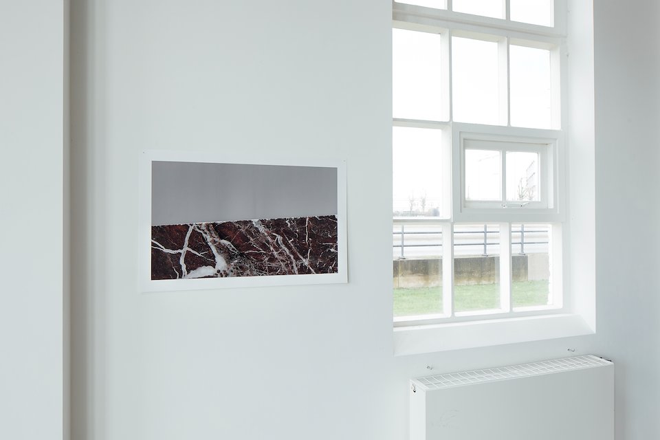
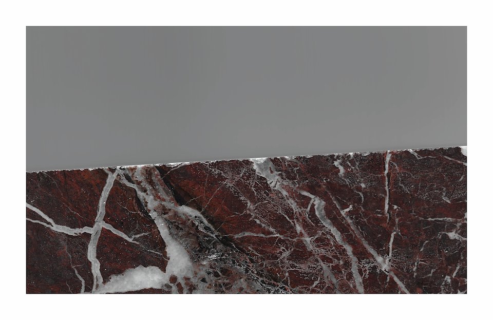
Rosso Levanto, Giclée print, 52 x 85cm
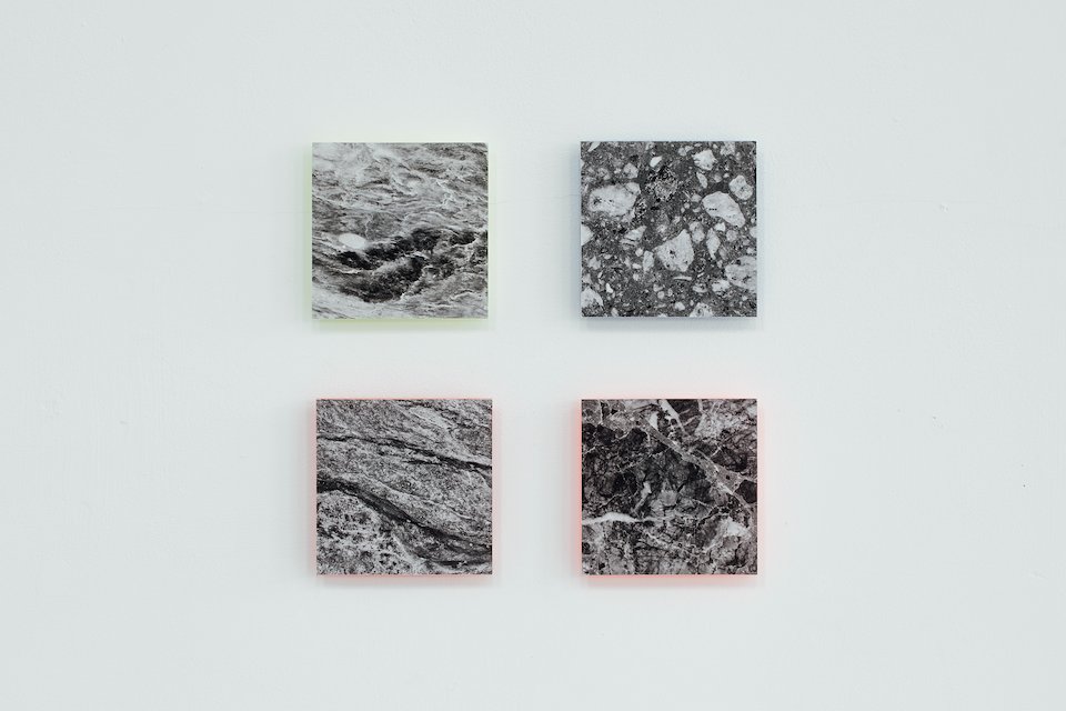
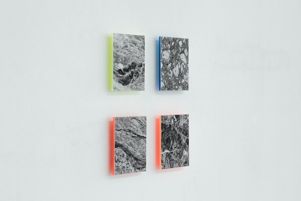
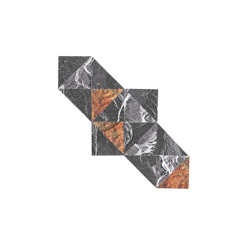
Surfacing 1-4, Giclée prints mounted on Perspex, 10 x 10cm
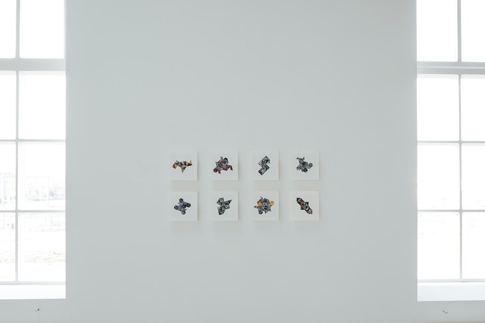
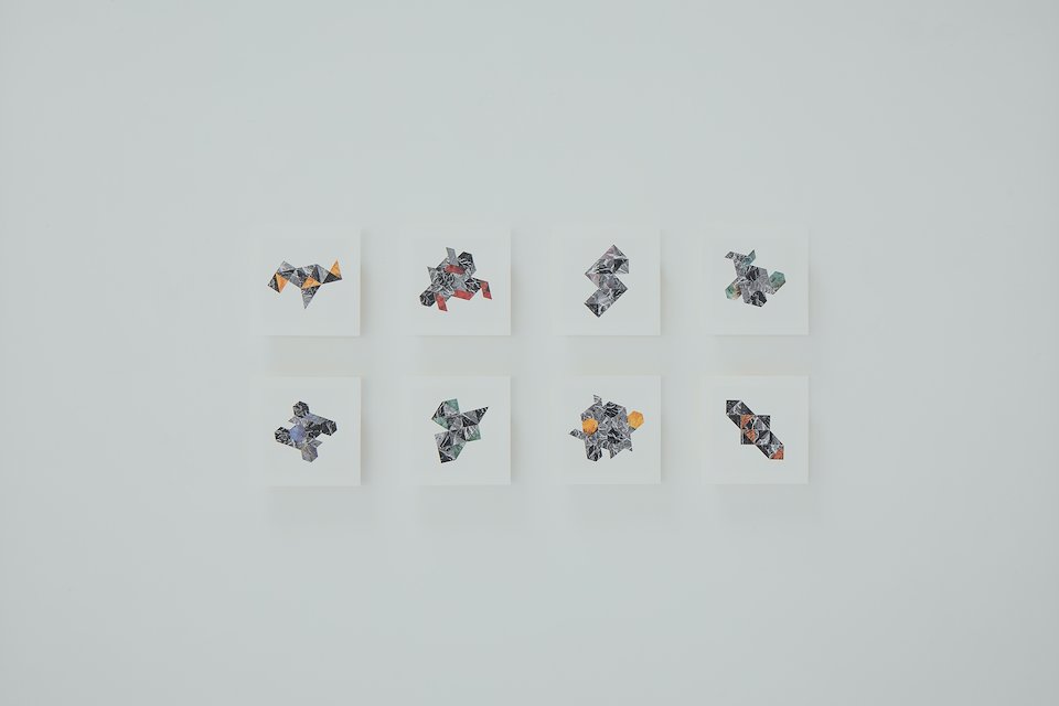
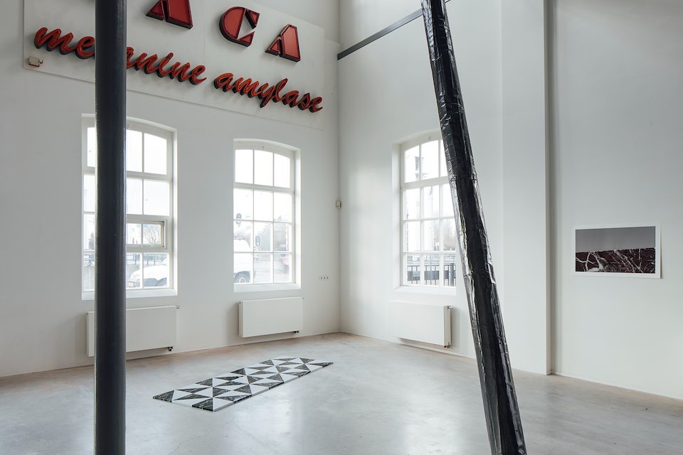
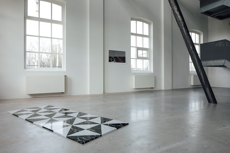
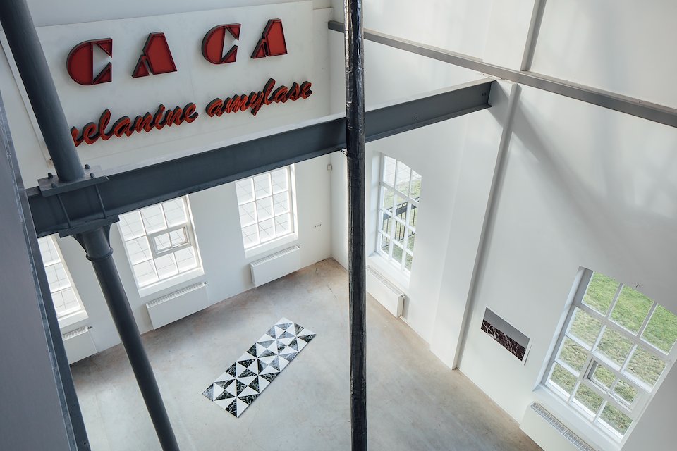
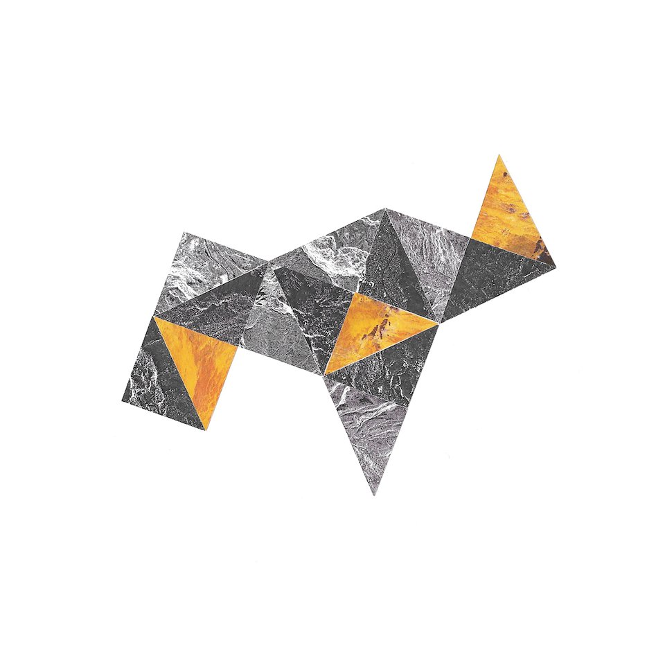
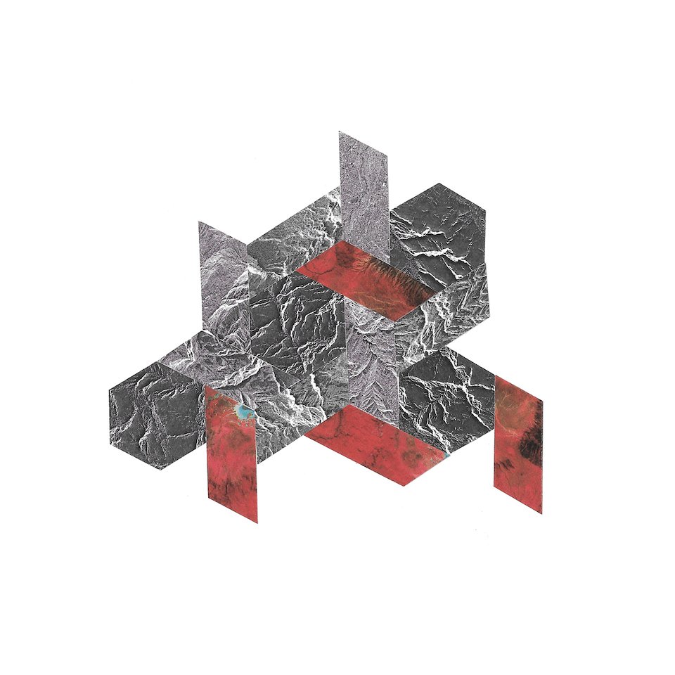
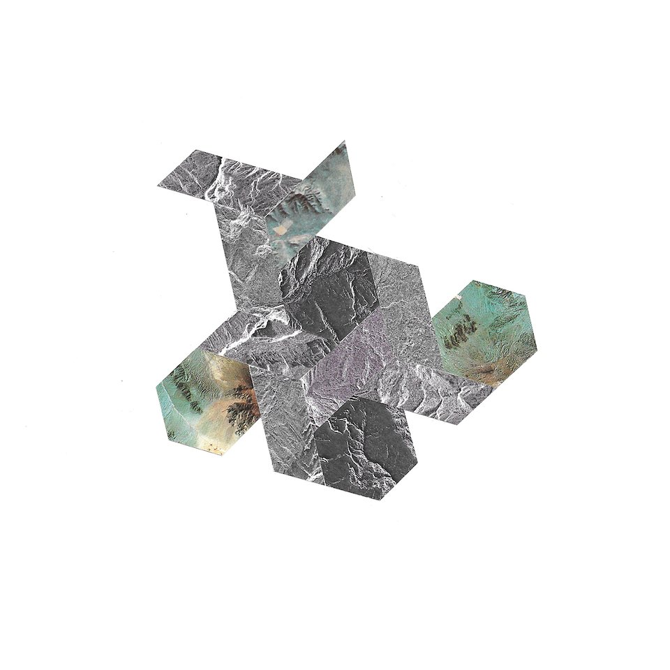
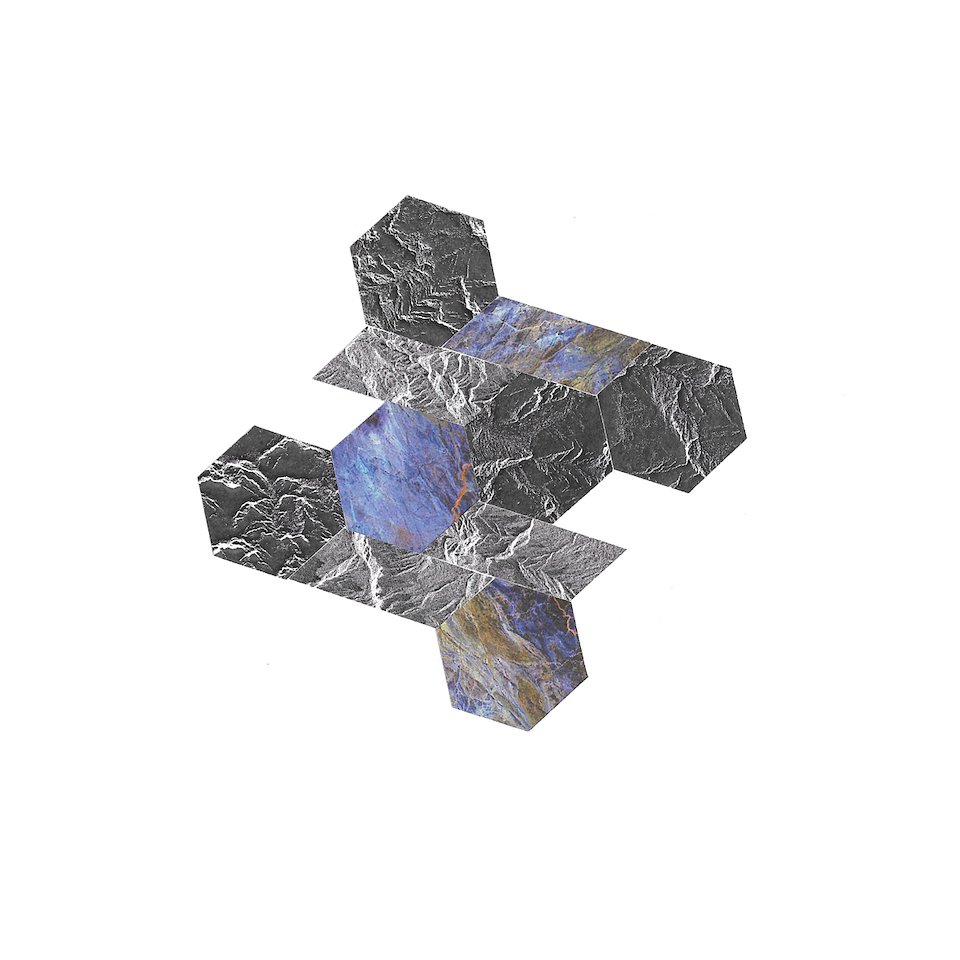
Tessellate 1-8, Sentinel-1 SAR data and found images, 22 x 22cm

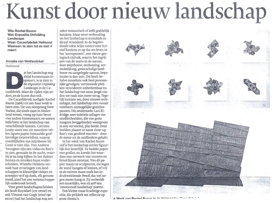
Unfolding Landscape
De Cacaofabriek, Helmond, NL
20 January – 4 March 2018
Rachel Bacon, Wieteke Heldens, Catriona Leahy, Andrew Youngson, Luci Eldridge
Photography by Andrew Youngson
-
Statement for show:
Luci’s practice is concerned with the scientific visioning of landscape as seen from satellites or through the cameras on spacecraft and rovers on other worlds. She is interested in how landscape is re-presented and re-constructed as digital images as a means to gain new knowledge. Her work combines traditional printmaking techniques, lens based media and collage with fictional visualisations constructed in 3D software, 3D printing, and projection.
The work created for Unfolding Landscape continues Luci’s fascination with landscape as seen from above, specifically through the cybernetic eyes of the European Space Agency and European Commission’s Sentinel-1A satellite. Sentinel-1A was launched in 2014 as part of the Copernicus programme and the satellite uses Synthetic Aperture Radar (SAR) imaging to monitor the Earth from space in all weather conditions. SAR is a non-photographic imaging process which uses bursts of microwavable energy pulses invisible to the human eye to repeatedly illuminate the planet’s surface, which are then reflected as echoes and recorded as digital data. The resultant images differ visually to photographic renditions; this is most evident in the distortion of landscape features. Slopes facing the radar are foreshortened and ones facing away from it are lengthened; mountainous areas appear squashed, as if we were viewing the landscape from an oblique perspective rather than an aerial one. In addition, the lightest areas of the images are not necessarily the highest points; surfaces that we usually consider rough can behave as smooth mirrors, and will therefore appear white in radar images. A fascination with how technology can alter our perception of landscape is at the heart of Luci’s practice and research, and for Unfolding Landscape, Luci has delved into Sentinel-1A’s image database. The images she has chosen to work with are those of the most extensive mountain range in Europe: The Alps.
The Sentinel-1 data reconstructs a vision of landscape we can never experience. For the show, Luci presents several new pieces that juxtapose these technological visions with more close-up and tactile modes of experiencing landscape; fragments of the Earth that have been sourced or mined, crafted and honed for our aesthetic pleasure. More specifically, the work plays upon the visual similarities between radar images of mountain ranges and certain types of marble. Just as Luci has mined the Sentinel-1A database, so too is marble extracted from the Earth to produce slabs that form decorative furnishings and art works. A metamorphic rock, marble is produced when limestone is exposed to high temperatures and pressures. This brutal process of its coming into being is hidden from view and a certain barrier of seeing and understanding this process may be likened to how radar imaging maps the Earth. Marble is made beneath the ground, whilst satellite data is produced on the very edge of the Earth. Both result in reconstituted fragments of landscape, produced through processes invisible to human eyes. And in both cases, landscape is transformed into something that is looked down upon, be it by our own human eyes as we walk across the floor of a European palace, or through the eyes of the machine orbiting far above.
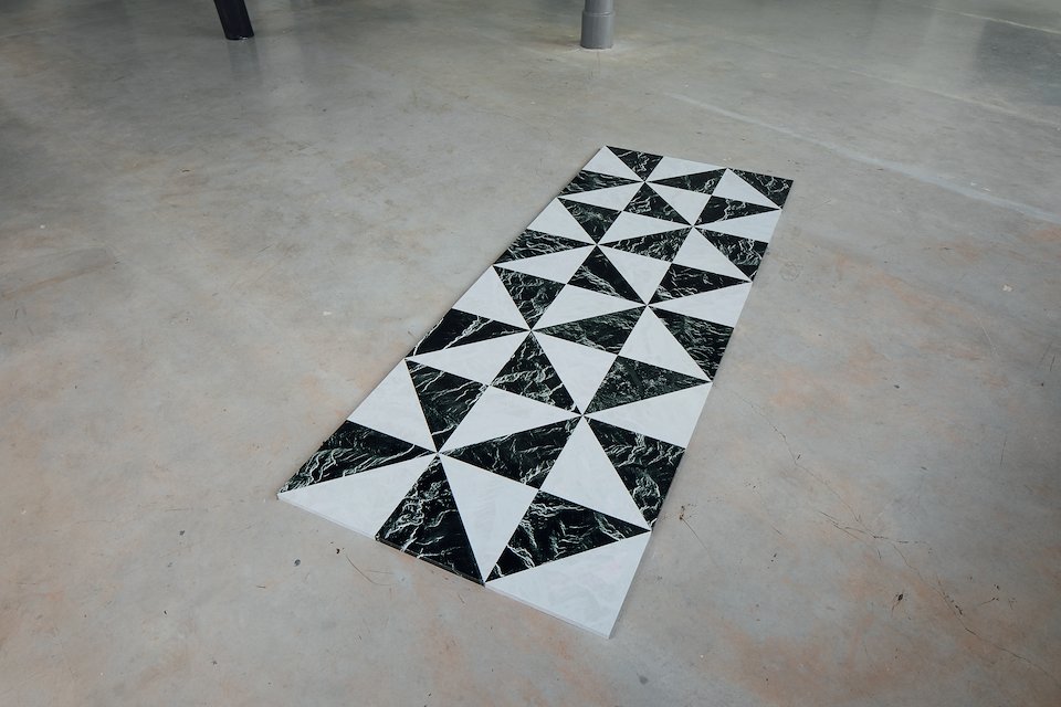
For Unfolding Landscape Luci is exhibiting a floor piece that directly plays upon the visual similarities between SAR imaging and Verde Tinos marble. The images are edited and re-presented as tiles; landscape here is segmented and re-constructed, to be looked down upon from above. In opposition to the highly technical imaging instruments on the Sentinel-1A satellite, Luci uses the home scanner as a means to image and re-imagine fragments of the Earth. The print ‘Rosso Levanto’ shows one result of this more tactile form of imaging. Enlarged and blown out of proportion fragments become abstract, painterly renditions; the scanner yields a vision of landscape that is precise yet indistinct. As a kind of low-fi sketching technique, Luci also uses collage to playfully appropriate source material. The collages she has produced for Unfolding Landscape continue her obsession with fragmenting and re-presenting landscape in a more immediate fashion.
At the heart of the work lies the notion of reconstructed landscape and ultimately the role technology plays in forming humanity’s relationship to the Earth. Luci’s work is marked by a fascination with digital modes of seeing and visualising in which images and objects are employed in a dialogue with one another to explore landscape as something that is both distant and tangible.
Exhibition funded by Stroom Den Haag.